
Local officials keeping eyes on Hurricane Isaias, potential impacts on Dublin, Laurens Co.
Laurens County officials are keeping their eyes on Hurricane Isaias.
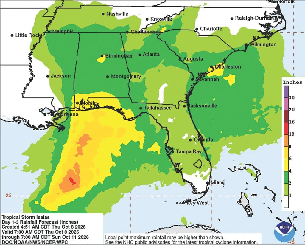
As of Thursday, the predictions for Hurricane Isaias had the storm hitting on the west side of Alabama, with the outside right edge of the storm either just missing or striking Dublin, Laurens County.
Of course, this is just a prediction, and depends on if the storm shifts to the west or east.
“I was just looking over the latest information from the National Weather Service,” said Laurens County Emergency Management Agency Director Bill Laird. “When it comes to storms like this, the most reliable forecast is the one you get about the time it makes landfall. That is about 36 hours from now. Of course with as much rain as we’ve had in the past, we’ll definitely have potential for some flash flooding if we have a lot of rain in a short amount of rain. Folks need to be on alert for that.”
As of Thursday morning, the latest track had Isaias tracking west, Laird said. Everything depends on how big the storm gets after making landfall. The NWS has predicted a level one marginal risk (five percent chance) when it comes to flash flood, a level two for risk of excessive rainfall (15 percent chance) and a level one for severe weather with a slight risk of tornadoes, damaging wind gusts and light risk of hail.
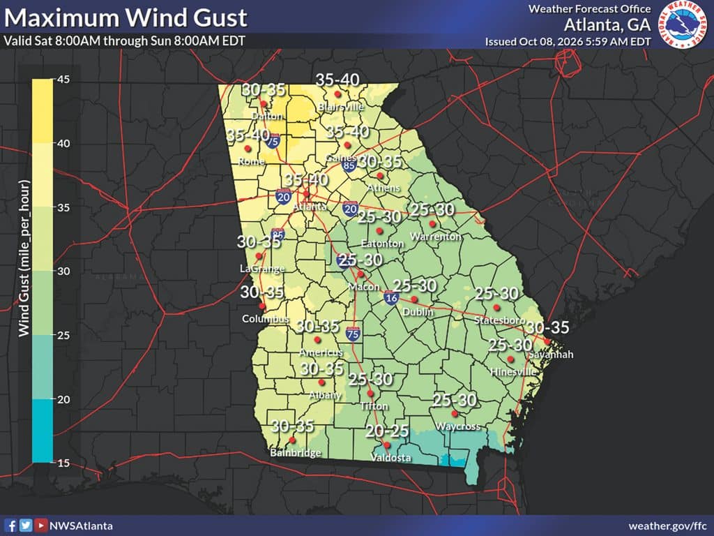
“What they are forecasting right now is that we can have maximum wind gusts around 25 to 30 miles per hour,” Laird said.
And no matter where it hits, Laird and Dublin Fire Chief Matthew Cutler know anything coming from Isaias will put this area on the dirty side of the storm.
“As we know, all it takes is a little push this way or that way to change everything, for the good or the bad,” Cutler said.
What comes to mind is how Hurricane Helene shifted west, bringing the eye of the storm right over Dublin, Laurens County in September of 2024.
“Helene shifted and moved and we had (Hurricanes) Michael (2018) and Irma (in 2017) do the same thing,” Laird said.
The timing of the storm is late Friday night into early Saturday morning. Unless it is an emergency, people should be at home. People need to have a reliable way to receive weather alerts for severe thunderstorm warnings or tornado watches and warnings.
“They need to be sure that they are getting their weather from reputable sources,” Laird said. “There are social media people who try to make it out that they know more than the news media. They take information from several others and put it out there.”
Laird said it is important to secure anything in the yard that may fly away during the storm. Heavy downpour of rain may also be a concern.
“We may see some power outages associated with this,” Laird said.
After a storm, people need to remember not to touch any lines on the ground.
“Any power line should be treated as a power line or as potentially an energized line,” Cutler said. “You don’t need to touch it or even get close to it. Electricity can travel through the ground. If the power is out, we have more than likely already received calls and we have investigated and have notified Georgia Power, or if you are in the county, the EMCs. They are not going to show up and restore anything until it is safe for them to do so because their crews need to be safe.”
Laird said they will continue to have briefings about Hurricane Isaias throughout Thursday and Friday.
“We’ll be coordinating with the cities and county, and public works to make sure that we are ready to address any issues that may arise,” Laird said. “The further we are away from the eye, the less of an impact we will get.”
Author

Related Articles
Dublin school board proposes tax increase
The advertised hike of 3.9 percent would generate just $40, officials said.
Twiggs County: 2 men arrested in prison dropping scheme
Two men were arrested in Twiggs County over the weekend for their alleged involvement in a prison drop.
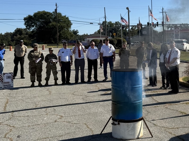
Alamo City Hosts US Flag Retirement Ceremony with VFW
The city of Alamo hosted a retirement ceremony for United States flags on September 26 in the city’s flower garden.